Transportation, Immigration, Irrigation, Transformation
When the Northwest tribes had been dealt a final, brutal blow at the close of the Nez Perce War in November 1877, Chief Joseph’s band was exiled to Kansas. Then, in spite of the promises made by Army commanders Colonel Nelson Miles and General O.O. Howard,[1] the US Government banished Chief Joseph and the non-treaty Indians (Nez Perce and Palouse) who fought for their homelands to Indian Territory in Oklahoma. General Oliver Otis Howard, his aide Lieutenant Charles Erskine Scott Wood and their meager patrol of troops returned to Vancouver Barracks to regroup and reorganize military tactics as yet one more tribe within the Department of the Columbia prepared for war – the Bannocks.
Until 1878, few settlers were attracted to the harsh wastelands of the Sacajawea Park site, spurning the sand, sagebrush, parched lands and obnoxious windstorms in favor of the attractive, fertile valley of the Willamette or the highly-accessible and densely forested Puget Sound. But the Northern Pacific Railroad, aided by the Oregon Steam Navigation Company reconfigured the Columbia Plateau region dramatically within less than three years.
The water level at the confluence site of Sacajawea Park was more than twenty-two feet lower throughout the region than it is today.[2] Steamboats in all shapes and sizes joined native canoes on the Columbia and its tributaries as early as 1836 when the Hudson Bay Company imported the Beaver and the Otter from England. Each vessel was less than 36 feet long with a draft of about three feet but they effectively operated like tugboats on the rivers and lakes of western Washington. These self-propelled, wood-fired steamers were best suited to the more protected waters of inland rivers and Puget Sound. The HBC soon after transferred their maritime operations and agricultural base north from Fort Vancouver toward the 49th Parallel for greater effectiveness and what they believed to be away from the concentrated flow of American settlement in the 1840’s.
In 1846, the international treaty boundaries were declared and approved, permanently moving the United States jurisdiction boundary northward to the 49th Parallel, and it was agreed that the British would reside north of the parallel. Floodgates for American settlement in the Pacific Northwest sprang open. With US citizens spread throughout the region already and more coming across the country in covered wagons on the Oregon Trail, the demand rose for US military troops, US law enforcement, schools and organized communities, improved transportation and mapped routes, and delivery of the US mail. Like tribal villages, communities were built at the water’s edge, usually with store fronts facing outward and allowing the free flow of goods between towns and other centers of population. The first major wagon road in Washington was not built until 1859 – well over thirty years after the major settlement at Hudson’s Bay Company, Fort Vancouver. There was no need. Horses and wagons traversed short distances between farms and towns and neighbors, but steamboats were already a powerful business as early as 1855, replacing the hearty voyageurs and tribal people who once paddled magnificent canoes from place to place. The steamboats’ success was guaranteed by federal contracts for hauling troops between the forts as they were built, and most profitably and dependably, by carrying the US mail.
One of the earliest families to foster steam boating was William H. Gray and his sons. Gray came west from Missouri with the Whitman-Spaulding party in 1836 as a “mechanic” and helped build the mission at Walla Walla and assisted the Spauldings in building their mission at Lapwai. He and his young sons, all born in the Northwest, built up a steamboat business on the Columbia and Snake Rivers that grew rapidly with government contracts, Eastern investors, railroad entrepreneurs, soon-to-retire army officers, and skilled pilots and captains like his sons William Polk Gray (at Pasco and above Celilo Falls) and James Gray (Vancouver/Portland crossing and lower Columbia River to the mouth.)
While the nation’s Civil War raged in the East, gold strikes hit at Orofino, Idaho, in the early 1860’s on Nez Perce land. In 1863, American miners demanded of the beleaguered President Abraham Lincoln and Congress a renegotiation of the Nez Perce Treaty of 1855, while steamboat traffic boomed from Lewiston, ID (near Lapwai) down to Portland, OR. Landings sprung up along the river route for cord wood to fuel the boats and to board passengers and freight headed to the gold fields and digs.
On June 7, 1879, the Palouse Gazette announced that a town was planned at the mouth of the Snake River. Settlers of the new community known as “Ainsworth” (in honor of Captain John C. Ainsworth, president of the Oregon Steam Navigation Company) declared that the town was “treeless.”[3] Even so, a sawmill was established there by late summer 1879, as construction began on the Northern Pacific’s Pend Oreille Division, connecting the region between the Columbia River and Helena, Montana.
Tribal activities at the Sacajawea Park site ceased and by November 1879, the Northern Pacific Railroad was laying out the town site of Ainsworth. At Walla Walla, firms provided over 40,000 railroad ties and iron rails that were shipped upstream on the steamboats Harvest and Annie Faxton.
Securing ties for the tracks was a challenge for railroad builders due to the utter lack of trees. Lumber was procured in the Blue Mountains, the Cascades, and regional business men held contracts to deliver 1.5 million feet of saw-logs and 6000 cedar telegraph poles to the Ainsworth mill, in addition to their contracts to deliver ties and bridge timbers for 490 miles of railroad. Payment was in gold.[4]
Fluctuating water levels on the Yakima River and frequent log-jams on the unharnessed rivers created environmental havoc for all parties. Booms broke loose, ties and logs scattered down the Columbia, and yet, the railroad pushed on. Like a ravenous monster, even more lumber was needed for ties, bridges, and construction so the railroad turned to the upper Clearwater River region where only two years earlier the Nez Perce War raged.
More new mills sprung up between Ainsworth, WA and Celilo Falls, OR, where they sawed logs for Northern Pacific Railroad. Businesses boomed, gold flowed and yet another sawmill was built at Ainsworth in 1881 with an estimated output of 65,000 to 80,000 feet of rough lumber per day.[5]
The landscape changed dramatically as track was laid, bridges and trestles were built, and wells were dug. Food and forage were shipped in to supply hundreds of men and their mules and horses as they worked. Water towers and a ready source of water would be needed for the steam boilers of locomotives at various depots along the route. Tunnels were blasted through the rock and eroded the natural flood plains with massive gravel piles left in their wake. The natural flow of the rivers was altered occasionally shooting flumes of water over cliff edges.
Housing was needed for the rail workers at Ainsworth. The workforce was about equally divided in the tiny town between whites and Chinese. Bette Meyer writes in Ainsworth: A Railroad Town: “In those days, muscle built railroads. The Chinese, imported specifically for railroad work, accomplished much of the back-breaking job. It was not uncommon for a Chinese employment broker to contract for a crew of about forty men; he arranged for all the details for employment, insuring that the laborers were supplied with their own cooks and a leader, usually English-speaking. He not only paid this group their wages, but assured his own earnings by requiring the provisions and equipment be purchased from him. Demands of construction required more and more workers until at one time there were over 7000 Chinese grading the roadbed and over 1000 whites laboring on bridges and laying track.”[6]
There is neither record of Indian labor on the railroad at Ainsworth nor even a mention of the former inhabitants of that site during the period of 1879-1884. Like sand blown into the wind, they vanished to reservations and wandered away in despair from the unwelcome and clamorous town folk.
When the white laborers demanded higher wages, the railroad retaliated by sending in more Chinese laborers at lower wages. Labor disputes and racial prejudices involving Chinese at Ainsworth soared and special taxes and exploitation followed.
Debauchery and vice were leading attractions at Ainsworth. One March evening in 1881 a group of citizen vigilantes attacked the opium dens, gambling halls and houses of prostitution. Hangings and mayhem reigned for several days as lawlessness attempted to rout lawlessness. Many settlers of the surrounding region characterized the town as a “whiskey-drinking, card-playing, Chinese Ainsworth.”[7] Most felt Ainsworth with its “six-shooters and saloons” would have to be wiped out to begin again respectably.[8]
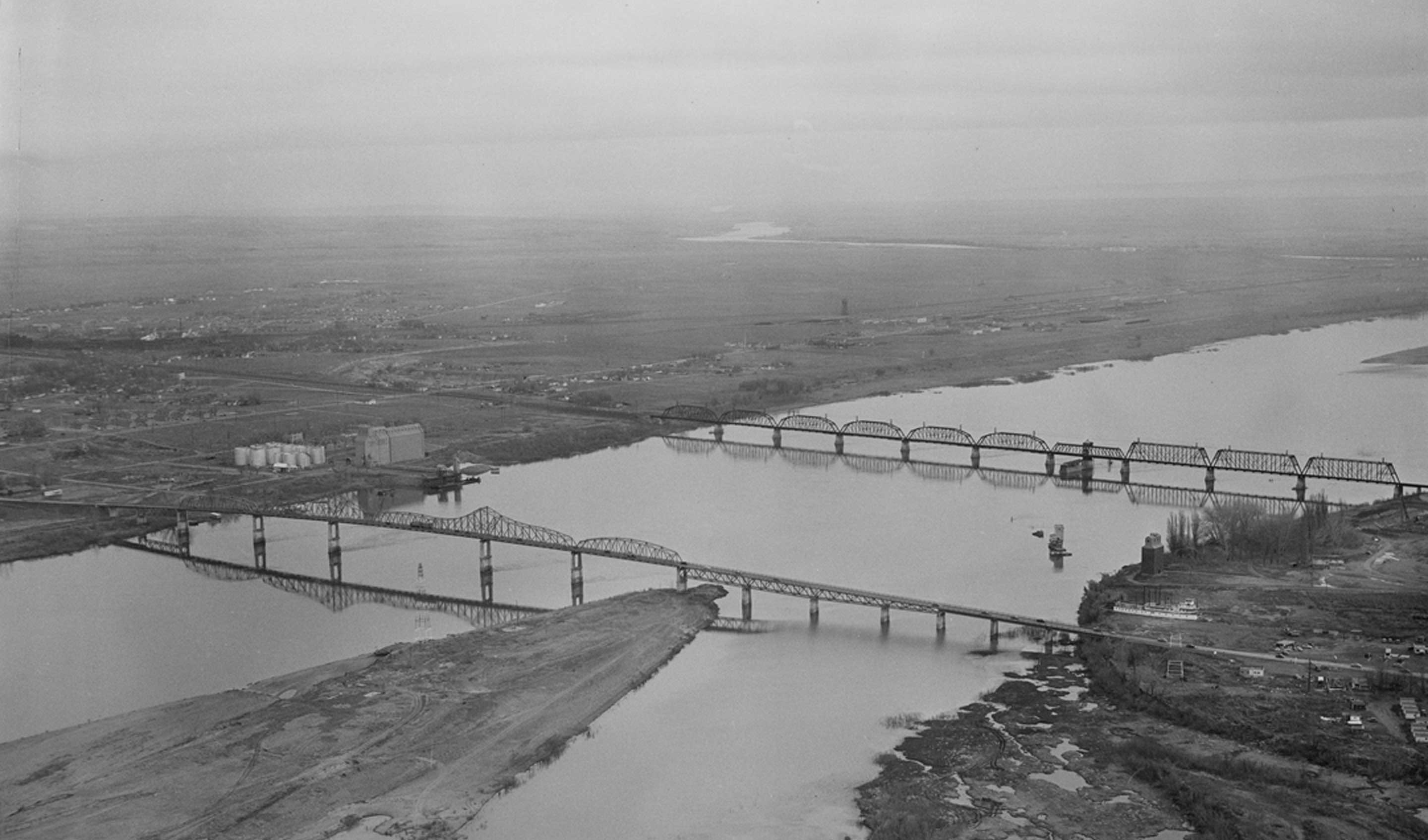
But Ainsworth thrived. Construction projects were so phenomenal and the crews temporary that a devoted corps of residents, including steamboat Captain William P. Gray hung on and petitioned for the formation of a new county and county seat. They succeeded when in 1884 Franklin County was created and Ainsworth was the center of its government. The Northern Pacific Railroad opened a new agency at “Pasco Junction“ very close to Ainsworth. In less than a month two saloons, three businesses serving hot meals and a hotel were established there. The railroad laid out a town site and Pasco became the railroad transfer site.[9] Railroad buildings were easily moved from Ainsworth to Pasco by rail where the Northern Pacific built a round-house, a stockyard, a well, a depot, an ice house, and a water tank. The school at Ainsworth was transferred to Pasco in 1885 and the entire camp of Chinese laborers which by then dwindled to about 300 men and women moved from Ainsworth to Pasco.[10]
Fire consumed most of Ainsworth after Pasco began. By 1898 it was mostly a ghost town with a few ship construction businesses dating to 1884 still operating at the site. Railroad ferries continued to shuttle cars across the Columbia to Kennewick during peak operating periods when the railroad bridge overflowed with activity. Ainsworth started, stopped and sputtered along as railroad building and financiers waxed and waned over the next twenty years. At last sand and sagebrush recaptured the town site and today only faint remnants of a once booming metropolis may be glimpsed next to Sacajawea Park.
Construction of the nation’s first transcontinental railroad forever altered the ethnic, cultural and ecological landscape of kinship and trading grounds of Columbia Plateau and Plains tribes. The site was completely and irrevocably transformed in less than five years from a ceremonial destination that had functioned for more than ten thousand years.
Unwilling to shrivel with defeat and blow away, community leaders at Pasco and the neighboring city of Kennewick, looked for rapid ways to irrigate the empty lands that surrounded them. Irrigation was the answer and a series of designs for coffer dams, canals and irrigation ditches evolved that watered the desert and helped turn it into fields of wheat and potatoes. Works Progress Administration efforts dealt with land reclamation issues in the 1930’s and the Army Corps of Engineers began to study the idea of a series of dams on the Snake and Columbia Rivers that would aid in irrigation and produce cheap hydroelectric power. Those plans were shelved as World War II emerged. Forty-two thousand dollars was expended through the WPA for improvements at Sacajawea Park.[11]
During World War II, the federal government selected Hanford and White Bluffs, WA, about fifteen miles away from Sacajawea Park for the center of a top secret mission. Long before construction of the Hanford Nuclear Site, the area had been inhabited by various Native American tribes, including the Yakama, Nez Perce, Umatilla, Cayuse, and Walla Walla. However, in 1855 many of these tribes signed treaties with the United States government and a reservation system was devised that relocated many native people to other regions. The tribes reserved the right to continue many practices on the ceded lands, such as to fish from any stream within or adjacent to the territory, to hunt, to graze their horses and cattle on open and unclaimed land, and to practice religious traditions at locations they considered sacred.
In January 1943, Hanford was chosen by the government as the site for the world’s first full-scale plutonium production plants. It was considered an ideal place because of the remote location, the access to railroad systems, the proximity to the Columbia River needed for cooling the reactors, and the abundance of hydroelectric power generated from dams along the river. More than 1,500 residents were involuntarily removed in early 1943 to make way for construction. Residents had from three days to two months to move and the Government burned homes and orchards to clear the site for Hanford Nuclear Power Plant. Thousands of workers moved from across the country to the area. By 1945, 554 buildings were built, including the B, D, and F Reactors; T, B, and U processing canyons; 64 underground high-level waste storage tanks; and many facilities dedicated to fuel fabrication in the 300 Area. The Hanford Project also constructed 621 kilometers (386 miles) of roadway, 254 kilometers (158 miles) of railroad, 80.5 kilometers (50 miles) of electrical transmission lines, and the city of Richland that was capable of housing 17,500 people. Progress at the Hanford Site occurred quickly and secretly and, as a security measure, local and state officials were not even informed about the purposes of the site.
The region burgeoned with growth as the population swelled with over 50,000 construction workers most of whom had not the least idea of what they were building. Many of the Hanford operations remained top secret, including the dangerous health hazards visited on the entire region until the 1980’s, just about one hundred years after the ceremonial kinships grounds at Sacajawea Park were supplanted by a different form of technology – the railroad.
Dam construction in the 1950’s raised the water levels of the rivers and submerged once sacred tribal lands and ceremonial plains. The eco-balance affecting nature, land and life changed forever.
End Notes
[1] As officers of the US Army, Howard and Miles had no authority to direct the disposition of the captives once the war ended with Chief Joseph’s surrender at Bear Paw Mountain. Despite Chief Joseph’s popularity in the American press and a great many sympathizers among the American public, only Congress and the judicial system wielded the right to control their destiny. Eventually the band was exiled to the barren wastelands of Indian Territory where even more Nez Perce people perished due to disease and starvation. Rarely a congenial threesome, Howard, Miles and Lt. CES Wood collaborated to promote the return of Chief Joseph’s people to Lapwai. Falling short of that, a number of years later, the band was removed to the Colville Reservation in Washington but never to their homelands in the Wallowa country.
[2] With the construction of McNary Dam in 1953, the river edge that once supported tremendous cultural and ecological activity of tribal nature was inundated and completely submerged with 22.5’ of water. McNary Dam was not the first dam or canal created for irrigation. The Celilo Canal was dedicated in 1915 to great fanfare at the Sacajawea Park site, lauding the ecological changes wrought by man and the introduction of irrigation that opened vast tracks of desert land to agricultural and industry.
[3] Meyer, Bette E. Ainsworth: A Railroad Town. Washington: Ye Galleon Press. 1983. 8.
[4] Ibid. 9.
[5] Ibid. 10.
[6] Ibid. 11.
[7] Ibid. 14.
[8] Ibid.
[9] Ibid. 25.
[10] Ibid. 26.
[11] “Bone and Party Hear WPA Pleas.” The Spokesman-Review. 10/26/1936.